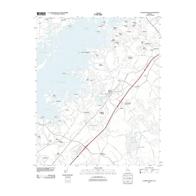
2011 Map of Flowery Branch
USGS Topo · Published 2011About this map
Lake Sidney Lanier dominates the landscape of this Hall County survey, its sprawling shoreline creating countless inlets such as Scotts Cove and Flat Creek. The map documents a period of significant residential and recreational development, seen in the dense network of landings and points like Snug Harbor Marina and Aqualand Marina. Inland, the traditional footprints of older Georgia communities remain visible, particularly through the concentration of local burial grounds including the Flowery Branch Cemetery and Mount Salem Cemetery. The transport network shows a clear shift toward modern infrastructure, with the path of Hog Mountain Rd and the Flowery Branch post office serving as local anchors. Family and local history researchers can trace the growth of settlements like Oakwood and Oscarville as they evolved alongside the managed waters of the Chattahoochee River basin.
Find a feature on this map
116 named features on this map. Tap any name to fly to it.
Don’t see what you’re looking for? This feature index may not catch every label — zoom into the map to look around manually.
Map Details
Editions of this 2011 Flowery Branch Map
This is the sole edition of this map. No revisions or reprints were ever made.
Other maps of this area

1890 · Suwanee
USGS Topo · 1:125,000

1891 · Gainesville
USGS Topo · 1:125,000

1894 · Suwanee
USGS Topo · 1:125,000

1954 · Greenville
USGS Topo · 1:250,000

1955 · Rome
USGS Topo · 1:250,000

1958 · Greenville
USGS Topo · 1:250,000

1958 · Rome
USGS Topo · 1:250,000

1961 · Rome
USGS Topo · 1:250,000

1963 · Rome
USGS Topo · 1:250,000

1964 · Hog Mountain
USGS Topo · 1:24,000