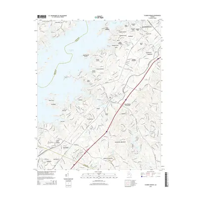
2014 Map of Flowery Branch
USGS Topo · Published 2014About this map
The sprawling shoreline of Lake Sidney Lanier defines the western landscape of this Hall County region, where the intricate fingers of the reservoir reach into coves such as Scotts Cove and Misty Cove. Inland, the map reveals the dense suburban development and road networks connecting Gainesville and Oakwood, characterized by numerous residential neighborhoods like Holiday Villa and Sallee Heights. For those investigating local history or genealogy, the sheet is particularly well-marked with burial sites, including the Oakwood Cem and Flowery Branch Cem, along with older rural markers like the Zion Hill Cem and Young Cem. The transit corridor following the Atlanta Hwy and the path of the railroad through Spout Spring Crossroads illustrates the modern infrastructure layered over the historical community of Wayne and the recreational growth of the lakefront.
Find a feature on this map
70 named features on this map. Tap any name to fly to it.
Don’t see what you’re looking for? This feature index may not catch every label — zoom into the map to look around manually.
Map Details
Editions of this 2014 Flowery Branch Map
This is the sole edition of this map. No revisions or reprints were ever made.
Other maps of this area

1890 · Suwanee
USGS Topo · 1:125,000

1891 · Gainesville
USGS Topo · 1:125,000

1894 · Suwanee
USGS Topo · 1:125,000

1954 · Greenville
USGS Topo · 1:250,000

1955 · Rome
USGS Topo · 1:250,000

1958 · Greenville
USGS Topo · 1:250,000

1958 · Rome
USGS Topo · 1:250,000

1961 · Rome
USGS Topo · 1:250,000

1963 · Rome
USGS Topo · 1:250,000

1964 · Hog Mountain
USGS Topo · 1:24,000