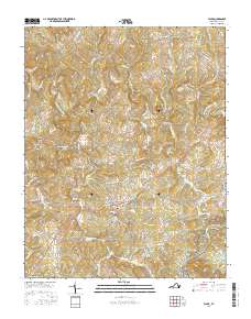
2016 Map of Floyd
USGS Topo · Published 2016About this map
The town of Floyd serves as a central hub for this corner of Virginia, where high-elevation plateaus meet the headwaters of the Little River. This 2016 survey highlights the intricate road network of Floyd County, where family names are etched into the landscape through locations like Jacksonville, Poff, and the historical site at Shelors Mill. The topography is dominated by distinct summits including Stockers Knob and the long spine of Wills Ridge, which parallel the course of Dodd Cr and other small tributaries. To the southeast, the terrain rises toward the Blue Ridge, where the scenic Blue Ridge Parkway skirts the edge of the quadrangle near The Haycocks. Local history and genealogy are anchored by rural burial grounds such as Baker Cem and Stockers Cem, which sit amidst a landscape of winding country lanes like Phlegar Hill Rd NE and Christiansburg Pike NE.
Find a feature on this map
95 named features on this map. Tap any name to fly to it.
Don’t see what you’re looking for? This feature index may not catch every label — zoom into the map to look around manually.
Map Details
Editions of this 2016 Floyd Map
This is the sole edition of this map. No revisions or reprints were ever made.
Other maps of this area

1890 · Christiansburg
USGS Topo · 1:125,000

1932 · Blacksburg
USGS Topo · 1:48,000

1937 · Blacksburg
USGS Topo · 1:62,500

1950 · Elliston
USGS Topo · 1:62,500

1953 · Winston-Salem
USGS Topo · 1:250,000

1955 · Bluefield
USGS Topo · 1:250,000

1955 · Winston-Salem
USGS Topo · 1:250,000

1957 · Endicott
USGS Topo · 1:62,500

1957 · Floyd
USGS Topo · 1:62,500

1957 · Bluefield
USGS Topo · 1:250,000