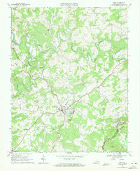
1968 Map of Floyd
USGS Topo · Published 1971About this map
The town of Floyd serves as the central hub of this late-1960s survey, surrounded by the high-elevation terrain of the Blue Ridge and Wills Ridge. The landscape is defined by the headwaters of the Little River and its various tributaries, including the West Fork and Oldfield Creek. Small rural communities and family-named landmarks are scattered throughout, such as the settlement of Poff and the Shelors Mill area.
Find a feature on this map
31 named features on this map. Tap any name to fly to it.
Don’t see what you’re looking for? This feature index may not catch every label — zoom into the map to look around manually.
Map Details
Editions of this 1968 Floyd Map
This is the sole edition of this map. No revisions or reprints were ever made.
Other maps of this area

1890 · Christiansburg
USGS Topo · 1:125,000

1932 · Blacksburg
USGS Topo · 1:48,000

1937 · Blacksburg
USGS Topo · 1:62,500

1950 · Elliston
USGS Topo · 1:62,500

1953 · Winston-Salem
USGS Topo · 1:250,000

1955 · Bluefield
USGS Topo · 1:250,000

1955 · Winston-Salem
USGS Topo · 1:250,000

1957 · Endicott
USGS Topo · 1:62,500

1957 · Floyd
USGS Topo · 1:62,500

1957 · Bluefield
USGS Topo · 1:250,000