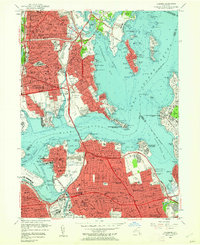
1955 Map of Flushing
USGS Topo · Published 1961About this map
St Raymonds Cemetery and the dense street grids of Westchester and Morris Park characterize the mid-century Bronx landscape as it stretches toward the Long Island Sound. This mid-1950s survey captures a pivotal era of infrastructure expansion, showing the Bronx-Whitestone (Toll) Bridge and Hutchinson River Parkway facilitating rapid suburban movement. Across the East River in Queens, the map details the burgeoning neighborhoods of Whitestone, Bayside, and Auburndale, balanced by recreational and institutional spaces like the Pelham-Split Rock Golf Course and La Guardia Field. Marine and military history is prominent along the coastline, anchored by the State Maritime College Fort Schuyler at Throgs Neck and the U S Military Reservation Fort Totten guarding the entrance to Little Neck Bay. The inclusion of the Long Island RR and the New York New Haven and Hartford RR highlights the transit-driven growth of these outer-borough communities.
Find a feature on this map
118 named features on this map. Tap any name to fly to it.
Don’t see what you’re looking for? This feature index may not catch every label — zoom into the map to look around manually.
Map Details
Editions of this 1955 Flushing Map
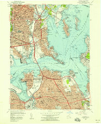
2 editions found
Other maps of this area

1889 · Brooklyn
USGS Topo · 1:62,500

1891 · Brooklyn
USGS Topo · 1:62,500

1891 · Harlem
USGS Topo · 1:62,500

1897 · Harlem
USGS Topo · 1:62,500

1897 · Brooklyn
USGS Topo · 1:62,500

1897 · Hempstead
USGS Topo · 1:62,500

1897 · Oyster Bay
USGS Topo · 1:62,500

1898 · Harlem
USGS Topo · 1:62,500

1898 · Hempstead
USGS Topo · 1:62,500

1898 · Brooklyn
USGS Topo · 1:62,500
Featured Places
- New York, NY
- North Hempstead, NY
- New Rochelle, NY
- Great Neck, North Hempstead
- Kings Point, North Hempstead