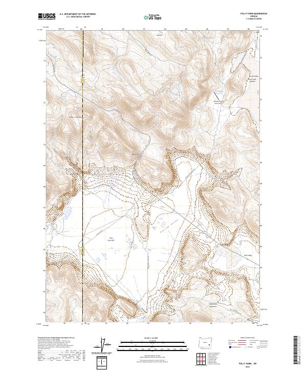
2024 Map of Folly Farm
USGS Topo · Published 2024About this map
Folly Farm Flat lies at the heart of this high desert landscape, serving as a focal point for a remote network of ranch roads and valley floors in eastern Oregon. The geography is defined by broad basins like Barren Valley and Sunrise Valley, separated by the rising elevations of the Sheepshead Mountains and prominent landmarks like Indian Creek Butte. This modern record reveals how water remains the primary organizer of human activity in the arid interior, evidenced by the scattered locations of Summit Springs and Black Bull Spring. The inclusion of the Black Bull Spring Ranch Airport and the junction of roads like Fields-Denio Rd and Folly Farm Rd highlights the continued reliance on isolated airstrips and long-distance desert routes for navigation across the Harney and Malheur county line.
Find a feature on this map
31 named features on this map. Tap any name to fly to it.
Don’t see what you’re looking for? This feature index may not catch every label — zoom into the map to look around manually.
Map Details
Editions of this 2024 Folly Farm Map
This is the sole edition of this map. No revisions or reprints were ever made.
Other maps of this area

1955 · Burns
USGS Topo · 1:250,000

1955 · Adel
USGS Topo · 1:250,000

1957 · Adel
USGS Topo · 1:250,000

1958 · Burns
USGS Topo · 1:250,000

1958 · Adel
USGS Topo · 1:250,000

1959 · Burns
USGS Topo · 1:250,000

1962 · Adel
USGS Topo · 1:250,000

1974 · Anderson Mtn
USGS Topo · 1:62,500
1974 · Turnbull Peak
USGS Topo · 1:24,000
1974 · Folly Farm
USGS Topo · 1:24,000