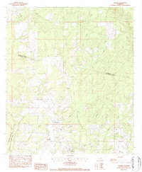
1983 Map of Folsom
USGS Topo · Published 1984About this map
Folsom serves as the focal point for this 1983 topographic study, situated where the Tchefuncta River meets several vital drainage systems in St. Tammany Parish. The landscape is defined by the intricate prongs of the Bogue Falaya, including the West Prong, Middle Prong, and East Prong, which carve through the piney woods of the Florida Parishes. This area shows a dense concentration of rural community centers, particularly noted by several family cemeteries and country churches such as San Pedro Ch and Greater Payne Chapel. The map reveals a transition between the more established settlement around Folsom Sch and the wooded parish boundary shared with Washington Parish. Local routes like Willie Garrett Road and Factory Road connect isolated homesites and small agricultural clearings, providing a clear view of the late-twentieth-century rural infrastructure before significant modern expansion in the region.
Find a feature on this map
40 named features on this map. Tap any name to fly to it.
Don’t see what you’re looking for? This feature index may not catch every label — zoom into the map to look around manually.
Map Details
Editions of this 1983 Folsom Map
This is the sole edition of this map. No revisions or reprints were ever made.
Other maps of this area

1939 · Zona
USGS Topo · 1:31,680

1942 · Onville
USGS Topo · 1:31,680

1942 · Waldheim
USGS Topo · 1:31,680

1942 · Husser
USGS Topo · 1:31,680

1942 · Robert
USGS Topo · 1:31,680

1942 · Thigpen
USGS Topo · 1:31,680

1942 · Wilmer
USGS Topo · 1:31,680

1950 · Folsom
USGS Topo · 1:31,680

1950 · Franklinton
USGS Topo · 1:31,680

1954 · Folsom
USGS Topo · 1:62,500