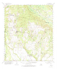
1958 Map of Folsom
USGS Topo · Published 1975About this map
The Bogue Falaya and its numerous tributaries, including Beason Creek and Bills Creek, define the landscape of St. Tammany and Washington Parishes in the late 1950s. The village of Folsom serves as a central hub, surrounded by a dense network of country churches and family cemeteries that reflect the area's social fabric, such as New Hope Ch and the Blackwell Cem. Educational landmarks like the Folsom Rosenwald Sch and Folsom Mission Sch provide insights into the mid-century community structure, while the St Gertrude Convent and St Benedict Chapel further south near Ramsay speak to the region's religious history. Industrial activity is concentrated along the Gulf Mobile and Ohio railroad corridor, where several Gravel Pits are located near Enon. The presence of Camp Covington and a Lookout Tower suggests the importance of both youth recreation and forestry management in this river-veined territory.
Find a feature on this map
111 named features on this map. Tap any name to fly to it.
Don’t see what you’re looking for? This feature index may not catch every label — zoom into the map to look around manually.
Map Details
Editions of this 1958 Folsom Map
2 editions found
Other maps of this area

1935 · Slidell
USGS Topo · 1:62,500

1935 · Covington
USGS Topo · 1:62,500

1935 · Ponchatoula
USGS Topo · 1:62,500

1939 · Ponchatoula
USGS Topo · 1:62,500

1939 · Slidell
USGS Topo · 1:62,500

1939 · Zona
USGS Topo · 1:31,680

1939 · Covington
USGS Topo · 1:62,500

1942 · Onville
USGS Topo · 1:31,680

1942 · Waldheim
USGS Topo · 1:31,680

1942 · Husser
USGS Topo · 1:31,680