
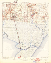
1935 Map of Ponchatoula
USGS Topo · Published 1935About this map
Illinois Central Railroad tracks bisect this 1930s coastal Louisiana landscape, cutting a straight line south from Ponchatoula toward the wetlands surrounding Jones Island. The map records a moment when rural life centered around local hubs like Sweet Home Ch and several small schools including Wadesboro Sch and Hollywood Sch. The transition from the settled uplands around Hammond to the marshy periphery of Lake Pontchartrain is clearly defined, with the Tangipahoa River and Tickfaw River snaking through the lowlands. Coastal infrastructure is anchored by Manchac Akers P O, situated at the vital water connection of Pass Manchac. This survey, compiled in part from early Air Corps aerial photography, captures the intricate network of bayous and the nascent highway system including U. S. Highway No 51 as it navigates the challenging terrain of the Maurepas basin.
Find a feature on this map
37 named features on this map. Tap any name to fly to it.
Don’t see what you’re looking for? This feature index may not catch every label — zoom into the map to look around manually.
Map Details
Editions of this 1935 Ponchatoula Map
2 editions found
Other maps of this area

1891 · Spanish Fort
USGS Topo · 1:62,500

1892 · Mount Airy
USGS Topo · 1:62,500

1892 · Bonnet Carre
USGS Topo · 1:62,500

1934 · Springfield
USGS Topo · 1:62,500

1935 · Covington
USGS Topo · 1:62,500

1936 · Ruddock
USGS Topo · 1:31,680

1936 · Bonnet Carre
USGS Topo · 1:62,500

1936 · Spanish Fort
USGS Topo · 1:62,500

1939 · Ponchatoula
USGS Topo · 1:62,500

1939 · Covington
USGS Topo · 1:62,500