
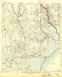
1934 Map of Springfield
USGS Topo · Published 1934About this map
Lake Maurepas and the intricate bayou networks of Livingston Parish dominate this 1932 survey, which was compiled in part from Air Corps aerial photography. The landscape is defined by the winding Amite River and Tickfaw River, where numerous landings like Gunboat Ldg and Warsaw Ldg facilitated local transport and trade before the modernization of the regional road system.
Find a feature on this map
113 named features on this map. Tap any name to fly to it.
Don’t see what you’re looking for? This feature index may not catch every label — zoom into the map to look around manually.
Map Details
Editions of this 1934 Springfield Map
2 editions found
Other maps of this area

1892 · Mount Airy
USGS Topo · 1:62,500

1892 · Bonnet Carre
USGS Topo · 1:62,500

1892 · Donaldsonville
USGS Topo · 1:62,500

1934 · Denham Springs
USGS Topo · 1:62,500

1935 · Ponchatoula
USGS Topo · 1:62,500

1936 · Ruddock
USGS Topo · 1:31,680

1936 · Bonnet Carre
USGS Topo · 1:62,500

1939 · Ponchatoula
USGS Topo · 1:62,500

1939 · Springfield
USGS Topo · 1:62,500

1939 · Denham Springs
USGS Topo · 1:62,500