
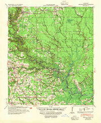
1939 Map of Denham Springs
USGS Topo · Published 1942About this map
Amite River meanders across this landscape, defining the borders between Livingston, East Baton Rouge, and Ascension Parishes. During this era, the river served as a vital corridor, marked by a Head of Navigation point and the French Settlement Ferry. The map captures a transition in transportation, showing the Illinois Central railroad cutting through Denham Springs in the north, while the Airline Highway begins to reshape movement through the southern parishes near Dutch Town.
Find a feature on this map
103 named features on this map. Tap any name to fly to it.
Don’t see what you’re looking for? This feature index may not catch every label — zoom into the map to look around manually.
Map Details
Editions of this 1939 Denham Springs Map
2 editions found
Other maps of this area

1892 · Mount Airy
USGS Topo · 1:62,500

1892 · Donaldsonville
USGS Topo · 1:62,500

1906 · Bayou Sara
USGS Topo · 1:125,000

1908 · Baton Rouge
USGS Topo · 1:62,500

1934 · Denham Springs
USGS Topo · 1:62,500

1934 · Springfield
USGS Topo · 1:62,500

1935 · Gonzales
USGS Topo · 1:31,680

1936 · White Castle
USGS Topo · 1:62,500

1939 · Springfield
USGS Topo · 1:62,500

1939 · Zachary
USGS Topo · 1:62,500