Old Maps of East Baton Rouge Parish, Louisiana
Explore 145 old maps of East Baton Rouge Parish, spanning from 1906 to today. These high-resolution historic maps reveal how streets, neighborhoods, landmarks, and natural features evolved over time — perfect for genealogy, metal detecting, research, and local history exploration.
What you can do with these maps:
- See how East Baton Rouge Parish changed over time: Compare historical maps to modern-day views to trace roads, homesites, rail lines & more.
- View detailed metadata: Each map includes creators, publishers, year, scale, and archive source.
- Overlay maps with satellite & LiDAR: Visualize the past alongside modern tools to explore terrain & human change.
- Trusted historical sources: Maps sourced from the USGS, Library of Congress, and other archives.
- Access maps your way: View online, download high-res files, or order prints for personal or research use.
Start exploring old maps of East Baton Rouge Parish to uncover forgotten places, hidden landmarks, and the deep history beneath your feet.
East Baton Rouge Parish, LA maps
(145)- 1906 Map of Bayou Sara
 1906 Bayou Sara1906 Print · USGSThe Feliciana parishes and the Mississippi River bottomlands come to life in this early twentieth-century survey. Genealogists can trace family footprints through river-town settlements like St Francisville or find early rail stops such as Gayden Sta (Gurley P.O.) and Slaughter.3 unique versions available
 - 1908 Map of Baton Rouge, 1921 Print
 1908 Baton Rouge1921 Print · USGSBaton Rouge and the surrounding river parishes are captured here at the dawn of the twentieth century, as the railroad network began to rival the river. Genealogists can locate family landmarks like Harelsons Store, Morning Star Church, and the community of Benton's.2 unique versions available
 - 1934 Map of Denham Springs
 1934 Denham Springs1934 Print · USGSLouisiana's river parishes come to life in the early 1930s as settlement spreads from the railroads into the bayous. Genealogists can trace family names at Broussard Grove Ch, locate the Rosenwald Sch, or find the old French Settlement Ferry crossing.2 unique versions available
 - 1939 Map of Zachary, 1941 Print
 1939 Zachary1941 Print · USGSEast Baton Rouge and East Feliciana parishes are documented here in the late 1930s, showing the vital rail-and-river economy before modern suburbanization. Genealogists can trace early landmarks like Leland College, Goodhope Ch, and the many cemeteries along White Bayou.2 unique versions available
 - 1939 Map of Denham Springs, 1942 Print
 1939 Denham Springs1942 Print · USGSLouisiana's river country comes alive in this pre-war survey of the Amite River basin during its transition to the modern highway era. Researchers can locate family roots at St Josephs Ch & Cem, track the old French Settlement Ferry, or find the Hoo Shoo Too Club.2 unique versions available
 - 1939 Map of Baton Rouge, 1947 Print
 1939 Baton Rouge1947 Print · USGSBaton Rouge and the Mississippi River transition from a plantation-based economy to a burgeoning rail hub just before World War II. Genealogists and historians can trace the foundations of local communities through landmarks like Poplar Grove Plantation, Rose Hill Ch Sch & Cem, and the riverfront at Port Allen.4 unique versions available
 - 1942 Map of Pine Grove
 1942 Pine Grove1942 Print · USGSSt. Helena Parish and the surrounding borderlands are captured here in the early 1940s as the regional logging rail era gives way to a modern highway network. Researchers can trace family sites at Sand Hill Cem and Salem Ch, or locate vanished local landmarks like Story Sch and the Old Grade.
 - 1942 Map of Pride
 1942 Pride1942 Print · USGSEast Baton Rouge and surrounding parishes are shown here in the early 1940s, a landscape defined by the Amite River and rural crossroads. You can trace community roots through many local landmarks, including Dennis Mills, Harrell Sch, and Stony Point Cem.
 - 1942 Map of Watson
 1942 Watson1942 Print · USGSLivingston and East Baton Rouge parishes are documented here during the early war years, centered on the community of Watson. Genealogists can locate family landmarks like Womack Cem and Odom Cem, or trace the grounds of the Greenwell Springs Sanatorium.
 - 1953 Map of Baton Rouge West, 1954 Print
 1953 Baton Rouge West1954 Print · USGSBaton Rouge and its riverfront were entering a period of significant post-war expansion in the early fifties. Genealogists can trace family roots through numerous parish landmarks like Poplar Grove Plantation, Cinclare, and the St John Cem.
 - 1953 Map of Plaquemine, 1954 Print
 1953 Plaquemine1954 Print · USGSThe river bends and plantation lands of Iberville Parish are shown here in the mid-1950s, highlighting the transition between water and rail transport. Researchers can trace historic family lands like St Louis Plantation or locate the Plaquemine Lock and Conrad Cem.
 - 1953 Map of St. Gabriel, 1954 Print
 1953 St. Gabriel1954 Print · USGSThe river parishes of Louisiana come into focus in the 1950s, showing a landscape of rail lines and bayous at the edge of the Mississippi. Researchers can locate the Louisiana Prison Farm Camp "M" or trace family sites near St Gabriel, Sunshine, and Mt Carmel Ch.
 - 1953 Map of Baton Rouge East, 1954 Print
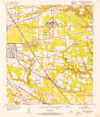 1953 Baton Rouge East1954 Print · USGSEast Baton Rouge Parish at the height of the early fifties growth spurt shows a landscape transitioning from rural parishes to suburban hubs. Genealogists and historians can locate family landmarks such as Kleinpeter Cem or rural centers like St George Ch and the Baton Rouge Engineer Depot.
 - 1953 Map of Prairieville, 1954 Print
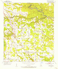 1953 Prairieville1954 Print · USGSAscension Parish during the early fifties shows a landscape of riverine bayous and burgeoning settlements along the newly modernized Airline Highway. Researchers can trace family roots through numerous landmarks like Oak Grove, Galvez, and local congregations at St Paul Ch and Zion Ch.
 - 1953 Map of Comite, 1954 Print
 1953 Comite1954 Print · USGSEast Baton Rouge Parish comes into focus during the early fifties, showing the rural communities and bayous north of the city. Genealogists and local historians can locate Central High Sch, the Odom Cem, and early settlements like Zion City.2 unique versions available
 - 1953 Map of Denham Springs, 1954 Print
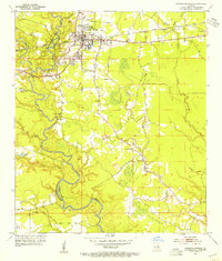 1953 Denham Springs1954 Print · USGSDenham Springs and the surrounding parishes are captured here in the early fifties, showing a landscape defined by river bends and rail lines. Researchers can trace family history through sites like Palmetto Cem, Eden Ch, and the 7th Ward Sch.2 unique versions available
 - 1954 Map of Watson, 1955 Print
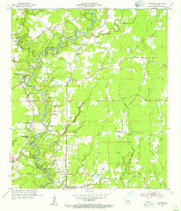 1954 Watson1955 Print · USGSThe Amite River floodplain comes to life in this mid-1950s survey of the border between East Baton Rouge and Livingston Parish. Researchers can locate family roots at Newsom Cem, trace the grounds of the Greenwell Springs Sanitarium, or find the historic Indian Mound.2 unique versions available
 - 1954 Map of Pride, 1955 Print
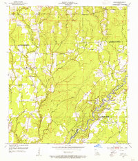 1954 Pride1955 Print · USGSEast Baton Rouge and surrounding parishes are captured here in the mid-1950s, a landscape defined by the winding Amite River and numerous bayous. Researchers can trace rural lineages through sites like Oaknolia, South Union Ch, and the Stony Point Cem.2 unique versions available
 - 1954 Map of Zachary, 1955 Print
 1954 Zachary1955 Print · USGSThe parishes of East Feliciana and East Baton Rouge are captured here in the mid-fifties, centered on the growing rail corridor between Zachary and Slaughter. Local historians can trace family-named sites like McHugh Cem, Shaffer Cem, and the McKowen Sch.
 - 1954 Map of Port Hudson, 1955 Print
 1954 Port Hudson1955 Print · USGSMid-century life along the Mississippi is captured here at the intersection of five Louisiana parishes. Genealogists and local researchers can trace family landmarks like Hermitage P.O., Beech Grove Ch No 2 Cem, and the historic Port Hudson riverfront.
 - 1954 Map of Walls, 1955 Print
 1954 Walls1955 Print · USGSThe Mississippi River's shifting course in the mid-1950s defines this West Baton Rouge landscape of landings and plantations. Researchers can locate family roots at Walls, trace the Texas and Pacific rail line, or find the Indian Mounds near Bueche.
 - 1954 Map of Fred, 1955 Print
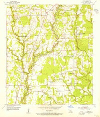 1954 Fred1955 Print · USGSEast Baton Rouge and East Feliciana Parishes are shown in the mid-fifties, dominated by the winding course of the Comite River. Researchers can trace rural life through numerous landmarks like the Eastern Star Sch, Deerford settlement, and Mose Chapel.
 - 1954 Map of Scotlandville, 1955 Print
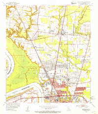 1954 Scotlandville1955 Print · USGSNorth of Baton Rouge in the mid-fifties, the Mississippi River bluffs supported a mix of academic institutions and river-dependent industry. Genealogists and historians can trace the campuses of Southern University and Leland College, as well as Free Negro Point and Nickwack Cem.
 - 1954 Map of Baton Rouge, 1974 Print
 1954 Baton Rouge1974 Print · USGSSoutheast Louisiana in the mid-fifties is captured here during a period of transition for its river and rail economies. Researchers can trace the path of the Mississippi River and find landmarks like the Bonnet Carre Spillway and Bayou Plaquemine.2 unique versions available
 - 1956 Map of Baton Rouge
 1956 Baton Rouge1956 Print · USGSSouth Louisiana at the height of the mid-century oil boom shows a landscape of river oxbows and rising industry. Researchers can trace family roots through river towns like Scotlandville or locate early industrial sites and Oil wells near Lake Maurepas.
Showing maps 1-25 of 145
Top cities of East Baton Rouge Parish
- Baton Rouge historical maps
- St. George historical maps
- Central historical maps
- Baker historical maps
- Zachary historical maps
Frequently asked questions
- What are the different types of historical maps available for East Baton Rouge Parish?
- What is the oldest map of East Baton Rouge Parish?
- Where can I purchase historical maps of East Baton Rouge Parish for my home or office?
- Where can I download high-res historical maps of East Baton Rouge Parish?
- Are there historical topographic maps available for East Baton Rouge Parish?
- Is there historical aerial imagery available for East Baton Rouge Parish?
- Where are historical maps of East Baton Rouge Parish sourced from?