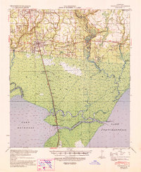
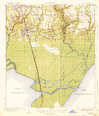
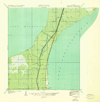
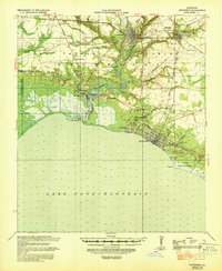
1939 Map of Ponchatoula
USGS Topo · Published 1939About this map
Ponchatoula and Hammond anchor the northern reaches of this coastal landscape, situated along the critical transit corridor of the Illinois Central railroad. The map reveals an economy deeply tied to the cypress swamps, evidenced by the Louisiana Cypress Lumber Co rail line extending south into the marshlands toward Jones Island. The transition from upland settlements to the tidal waters of Lake Maurepas and Lake Pontchartrain is marked by a network of bayous and rivers, including the Tangipahoa River and Tickfaw River.
Find a feature on this map
49 named features on this map. Tap any name to fly to it.
Don’t see what you’re looking for? This feature index may not catch every label — zoom into the map to look around manually.
Map Details
Editions of this 1939 Ponchatoula Map
This is the sole edition of this map. No revisions or reprints were ever made.
Other maps of this area

1891 · Spanish Fort
USGS Topo · 1:62,500

1892 · Mount Airy
USGS Topo · 1:62,500

1892 · Bonnet Carre
USGS Topo · 1:62,500

1934 · Springfield
USGS Topo · 1:62,500

1935 · Covington
USGS Topo · 1:62,500
1935 · Ponchatoula
USGS Topo · 1:62,500
1936 · Ruddock
USGS Topo · 1:31,680

1936 · Bonnet Carre
USGS Topo · 1:62,500

1936 · Spanish Fort
USGS Topo · 1:62,500
1939 · Covington
USGS Topo · 1:62,500