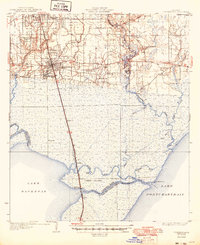
1935 Map of Ponchatoula
USGS Topo · Published 1949About this map
Ponchatoula and Hammond serve as the primary northern hubs on this 1930s survey, marking a transition from developed upland to the expansive marshlands surrounding Lake Maurepas and Lake Pontchartrain. The Illinois Central railroad cuts a straight line south through the wetlands, passing through isolated landings and settlements like Sharkey, Strader, and Galva before reaching Manchac Akers P O. This rail corridor was essential for commerce in a landscape dominated by water, where the Tangipahoa River and Bedico River meander toward the lakes.
Find a feature on this map
44 named features on this map. Tap any name to fly to it.
Don’t see what you’re looking for? This feature index may not catch every label — zoom into the map to look around manually.
Map Details
Editions of this 1935 Ponchatoula Map
2 editions found
Other maps of this area

1891 · Spanish Fort
USGS Topo · 1:62,500

1892 · Mount Airy
USGS Topo · 1:62,500

1892 · Bonnet Carre
USGS Topo · 1:62,500

1934 · Springfield
USGS Topo · 1:62,500

1935 · Covington
USGS Topo · 1:62,500

1935 · Ponchatoula
USGS Topo · 1:62,500

1936 · Ruddock
USGS Topo · 1:31,680

1936 · Bonnet Carre
USGS Topo · 1:62,500

1936 · Spanish Fort
USGS Topo · 1:62,500

1939 · Ponchatoula
USGS Topo · 1:62,500