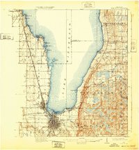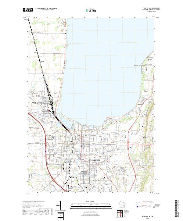
2022 Map of Fond du Lac
USGS Topo · Published 2022About this map
Fond Du Lac and North Fond Du Lac sit at the southern foot of Lake Winnebago, where the landscape is defined by the convergence of the West Branch and East Branch Fond du Lac Rivers. This survey details the urban expansion and shoreline development of the early 21st century, including the residential clusters at Minawa Beach and Hopokoekau Beach along the eastern shore. The geography is punctuated by significant institutional footprints, including Marian University and the University of Wisconsin Oshkosh Fond du Lac Campus. Local history is preserved in numerous burial grounds such as Rienzi Cem and Taycheedah Cem, while the industrial and transportation hub at the Fond Du Lac County Airport and the rail corridors near North Fond Du Lac anchor the region's infrastructure.
Find a feature on this map
151 named features on this map. Tap any name to fly to it.
Don’t see what you’re looking for? This feature index may not catch every label — zoom into the map to look around manually.
Map Details
Editions of this 2022 Fond du Lac Map
This is the sole edition of this map. No revisions or reprints were ever made.