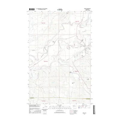
2017 Map of Forks
USGS Topo · Published 2017About this map
The town of Forks serves as a central hub on the Olympic Peninsula, situated at the confluence of several significant waterways including the Sol Duc River and the Bogachiel River. The settlement pattern follows the valley floors, with Forks Prairie and the Sol Duc Valley providing the most level ground amidst the rising terrain of the Olympic Mountains. The local economy is reflected in the Industrial Center and the presence of the Forks Airport, while the surrounding landscape is defined by prominent features such as Anderson Ridge and Grader Creek Hill.
Find a feature on this map
61 named features on this map. Tap any name to fly to it.
Don’t see what you’re looking for? This feature index may not catch every label — zoom into the map to look around manually.
Map Details
Editions of this 2017 Forks Map
This is the sole edition of this map. No revisions or reprints were ever made.
Other maps of this area

1935 · Ozette Lake
USGS Topo · 1:62,500

1935 · Lake Pleasant
USGS Topo · 1:62,500

1939 · Forks
USGS Topo · 1:62,500

1942 · Ozette Lake
USGS Topo · 1:62,500

1942 · Lake Pleasant
USGS Topo · 1:62,500

1943 · Copalis Beach
USGS Topo · 1:250,000

1951 · Copalis Beach
USGS Topo · 1:250,000

1953 · Cape Flattery
USGS Topo · 1:250,000

1956 · La Push
USGS Topo · 1:62,500

1956 · Ozette Lake
USGS Topo · 1:62,500