2024 Map of Forman
USGS Topo · Published 2024About this map
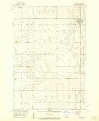
Forman serves as the focal point of this North Dakota prairie landscape, anchored by the Sargent County Courthouse and a cluster of local landmarks including the Forman Cem and Saint Marys Catholic Cem. The surrounding terrain is defined by a dense network of sectional roads and extensive conservation lands, most notably the Sargent County Waterfowl Production Area and several tracts of Sargent County WPA. These managed wetlands and production areas illustrate the region's commitment to wildlife preservation amidst its agricultural grid.
Find a feature on this map
39 named features on this map. Tap any name to fly to it.
Don’t see what you’re looking for? This feature index may not catch every label — zoom into the map to look around manually.
Map Details
Editions of this 2024 Forman Map
This is the sole edition of this map. No revisions or reprints were ever made.