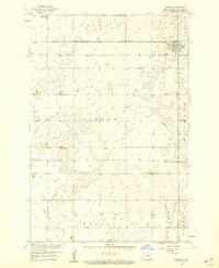
1958 Map of Forman
USGS Topo · Published 1959About this map
The town of Forman serves as the focal point of this 1950s survey, situated at a junction of significant rail lines including the Minneapolis St Paul and Sault Ste Marie and the Great Northern. This region of Sargent County is characterized by a high density of small prairie potholes and wetlands, with the Wild Rice River meandering through the southern townships of Taylor and Weber.
Find a feature on this map
16 named features on this map. Tap any name to fly to it.
Don’t see what you’re looking for? This feature index may not catch every label — zoom into the map to look around manually.
Map Details
Editions of this 1958 Forman Map
This is the sole edition of this map. No revisions or reprints were ever made.
Other maps of this area

1953 · Kidder
USGS Topo · 1:24,000

1953 · Newark
USGS Topo · 1:24,000

1953 · Milbank
USGS Topo · 1:250,000

1953 · Fargo
USGS Topo · 1:250,000

1956 · Fargo
USGS Topo · 1:250,000

1956 · Havana
USGS Topo · 1:24,000

1957 · Stirum
USGS Topo · 1:24,000

1957 · Cogswell
USGS Topo · 1:24,000

1958 · Milbank
USGS Topo · 1:250,000

1958 · Rutland
USGS Topo · 1:24,000