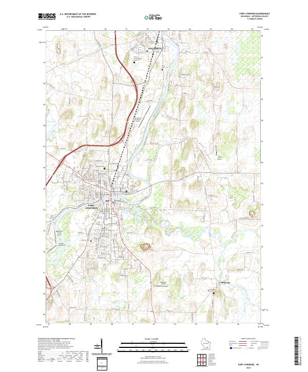
2022 Map of Fort Atkinson
USGS Topo · Published 2022About this map
The Rock River winds through the heart of this Jefferson County landscape, connecting the established communities of Jefferson and Fort Atkinson. This modern survey documents the contemporary suburban expansion and industrial infrastructure that has grown around these historic river towns. Aviation is a prominent feature of the local geography, with a high concentration of airfields ranging from the Fort Atkinson Municipal Airport to specialized landing strips like Blackhawk Island Airport, Christie Aerodrome, and Oakbrook Airport.
Find a feature on this map
152 named features on this map. Tap any name to fly to it.
Don’t see what you’re looking for? This feature index may not catch every label — zoom into the map to look around manually.
Map Details
Editions of this 2022 Fort Atkinson Map
This is the sole edition of this map. No revisions or reprints were ever made.
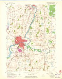
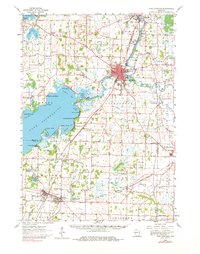
Historical Maps of Jefferson County Through Time
3 maps found