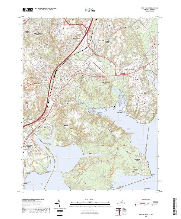
2022 Map of Fort Belvoir
USGS Topo · Published 2022About this map
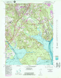
The massive military installation of Fort Belvoir occupies much of this landscape along the Potomac shoreline, anchoring a region defined by complex tidal inlets and suburban growth. The peninsulae of Pohick Neck, Belvoir Neck, and Mason Neck reach into the Potomac River, creating the sheltered waters of Pohick Bay and Gunston Cove. For genealogists, the map is remarkably dense with family burial grounds and small parish yards, such as the Millan Potter Family Cem, Triplett Family Cem, and the prominent Pohick Episcopal Church Cem. The terrain is also marked by significant infrastructure, including the Davison Army Airfield and the I-95 corridor, which bypasses established communities like Accotink, Lorton, and Newington as they transitioned into the modern era.
Find a feature on this map
86 named features on this map. Tap any name to fly to it.
Don’t see what you’re looking for? This feature index may not catch every label — zoom into the map to look around manually.
Map Details
Editions of this 2022 Fort Belvoir Map
This is the sole edition of this map. No revisions or reprints were ever made.
Historical Maps of Mason Neck Through Time
3 maps found