Loading...
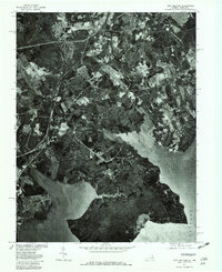
Loading map...1977 Map of Fort Belvoir
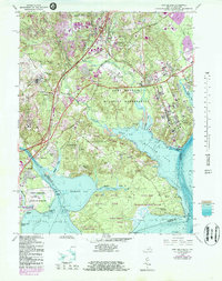
USGS Topo · Published 1982About this map
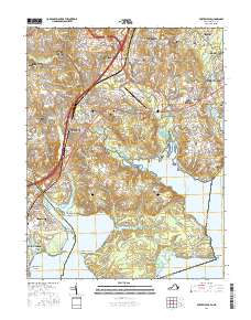
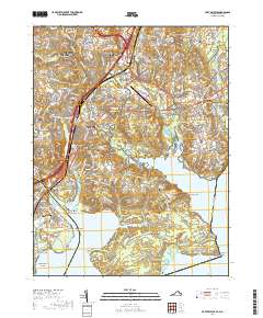
Gunston Cove and the widening reach of the Potomac River dominate this 1977 orthophoto, providing a photographic record of Northern Virginia’s coastal landscape. The imagery captures the suburban development and infrastructure of the late 1970s, showing the concentration of buildings and roads around Newington and Lorton in contrast with the dense wooded tracts and winding waterways of Pohick Creek and Accotink Creek.
Find a feature on this map
9 named features on this map. Tap any name to fly to it.
Don’t see what you’re looking for? This feature index may not catch every label — zoom into the map to look around manually.
Map Details
Date Portrayed1977
Date Published1982
PublisherU.S. Geological Survey
Map TypeTopographic
Scale1:24,000
Physical Dimensions21.9 x 26.8 inches
Editions of this 1977 Fort Belvoir Map
This is the sole edition of this map. No revisions or reprints were ever made.
Historical Maps of Lorton Through Time
7 maps found
Featured Locations
Source Details
SourceU.S. Geological Survey
CopyrightPublic Domain