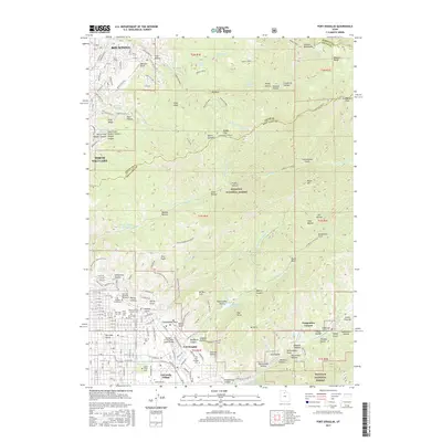
2017 Map of Fort Douglas
USGS Topo · Published 2017About this map
Fort Douglas and the eastern reaches of Salt Lake City dominate the lower half of this landscape, where the urban grid meets the steep slopes of the Wasatch National Forest. This 2017 study illustrates the dense concentration of civic and memorial sites at the base of the mountains, including the University of Utah campus and a significant cluster of interment grounds such as Mount Olivet Cem, Mount Calvary Catholic Cem, and B'Nai Israel Cem. The terrain rises sharply into the high ridges of Emigration Canyon and North Canyon, revealing a complex network of recreational paths like the Bonneville Shoreline Trail.
Find a feature on this map
112 named features on this map. Tap any name to fly to it.
Don’t see what you’re looking for? This feature index may not catch every label — zoom into the map to look around manually.
Map Details
Editions of this 2017 Fort Douglas Map
This is the sole edition of this map. No revisions or reprints were ever made.
Other maps of this area

1885 · Salt Lake
USGS Topo · 1:250,000

1925 · Ft. Douglas
USGS Topo · 1:125,000

1928 · Ft. Douglas
USGS Topo · 1:125,000

1950 · Fort Douglas
USGS Topo · 1:24,000

1951 · Fort Douglas
USGS Topo · 1:24,000

1951 · Salt Lake City South
USGS Topo · 1:24,000

1951 · Salt Lake City North
USGS Topo · 1:24,000

1952 · Sugar House
USGS Topo · 1:24,000

1952 · Farmington
USGS Topo · 1:24,000

1952 · Bountiful Peak
USGS Topo · 1:24,000