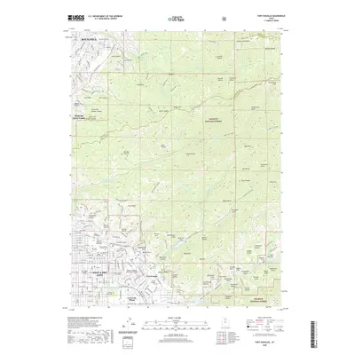
2020 Map of Fort Douglas
USGS Topo · Published 2020About this map
Fort Douglas stands as a focal point of this 2020 study, highlighting the intersection of military history and urban development on the eastern edge of Salt Lake City. This map captures a landscape defined by both institutional growth and natural preservation, with the extensive campus of the University of Utah and University Village transitioning into the steep canyons of the Wasatch National Forest. A significant concentration of burial grounds, including the Salt Lake City Cem, Mount Calvary Catholic Cem, and Shaarey Tzedek Cem, provides deep genealogical value for the region. The map also traces the critical water management of the area, from the Red Butte Reservoir to the Pleasant Valley Reservoir. High elevations like Grandview Peak and Black Mtn overlook the sprawling settlements of Bountiful and North Salt Lake, illustrating how the Wasatch Range constrains and shapes the urban footprint of the valley.
Find a feature on this map
99 named features on this map. Tap any name to fly to it.
Don’t see what you’re looking for? This feature index may not catch every label — zoom into the map to look around manually.
Map Details
Editions of this 2020 Fort Douglas Map
This is the sole edition of this map. No revisions or reprints were ever made.
Other maps of this area

1885 · Salt Lake
USGS Topo · 1:250,000

1925 · Ft. Douglas
USGS Topo · 1:125,000

1928 · Ft. Douglas
USGS Topo · 1:125,000

1950 · Fort Douglas
USGS Topo · 1:24,000

1951 · Fort Douglas
USGS Topo · 1:24,000

1951 · Salt Lake City South
USGS Topo · 1:24,000

1951 · Salt Lake City North
USGS Topo · 1:24,000

1952 · Sugar House
USGS Topo · 1:24,000

1952 · Farmington
USGS Topo · 1:24,000

1952 · Bountiful Peak
USGS Topo · 1:24,000