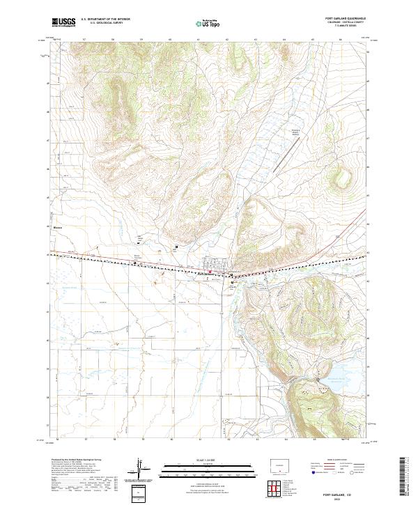
2022 Map of Fort Garland
USGS Topo · Published 2022About this map
The high desert valley of the San Luis Basin is defined here by an intricate network of irrigation engineering and early Colorado settlement. Fort Garland sits at the junction of the Sangre de Cristo Cr and Ute Cr, serving as a focal point for the region's historical development. The landscape is crisscrossed by essential water management features such as the Sangre de Cristo Ditch Number 3, Garland Ditch, and the Sangre De Cristo-Trinchera Diversion Canal, which direct flow toward agricultural lands and the Mountain Home Reservoir.
Find a feature on this map
64 named features on this map. Tap any name to fly to it.
Don’t see what you’re looking for? This feature index may not catch every label — zoom into the map to look around manually.
Map Details
Editions of this 2022 Fort Garland Map
This is the sole edition of this map. No revisions or reprints were ever made.
Other maps of this area

1889 · Huerfano Park
USGS Topo · 1:125,000

1892 · Huerfano Park
USGS Topo · 1:125,000

1954 · Trinidad
USGS Topo · 1:250,000

1955 · Trinidad
USGS Topo · 1:250,000

1958 · Trinidad
USGS Topo · 1:250,000

1959 · Trinidad
USGS Topo · 1:250,000

1965 · Blanca
USGS Topo · 1:24,000

1965 · Blanca SE
USGS Topo · 1:24,000

1965 · Twin Peaks
USGS Topo · 1:24,000

1967 · Fort Garland SW
USGS Topo · 1:24,000