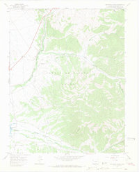
1967 Map of Fort Garland SW
USGS Topo · Published 1970About this map
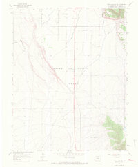
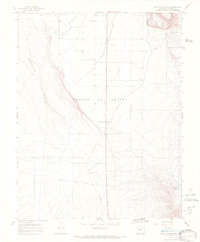
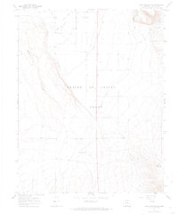
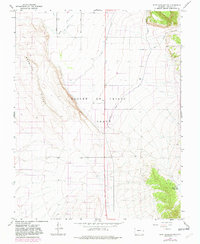
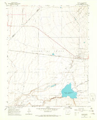
The Sangre De Cristo Grant dominates this landscape in Costilla County, where the transition from the Basaltic Hills to the valley floor is defined by a complex irrigation network. Essential to the high-altitude ranching and agriculture of the late 1960s, waterways like the Trinchera Canal, Highline Canal, and No 3 Ditch snake across the terrain to support local land use. The map reveals specialized infrastructure such as the Escheman Landing Strips, signifying the reliance on light aircraft in this expansive terrain. To the southeast, the Willow Creek Reservoir sits tucked against rising elevations, connected to the lower plains by a Jeep Trail and seasonal watercourses like Ojito Creek. This survey captures the region just before modern development patterns began to shift the traditional land grants of the San Luis Valley.
Find a feature on this map
11 named features on this map. Tap any name to fly to it.
Don’t see what you’re looking for? This feature index may not catch every label — zoom into the map to look around manually.
Map Details
Editions of this 1967 Fort Garland SW Map
5 editions found

Other maps of this area

1954 · Trinidad
USGS Topo · 1:250,000

1955 · Trinidad
USGS Topo · 1:250,000

1958 · Trinidad
USGS Topo · 1:250,000

1959 · Trinidad
USGS Topo · 1:250,000
1965 · Blanca
USGS Topo · 1:24,000
1965 · Blanca SE
USGS Topo · 1:24,000
1967 · San Luis
USGS Topo · 1:24,000
1967 · Ojito Peak
USGS Topo · 1:24,000
1967 · Trinchera Ranch
USGS Topo · 1:24,000
1967 · Fort Garland
USGS Topo · 1:24,000