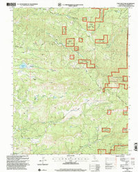
2001 Map of Fort Mountain
USGS Topo · Published 2004About this map
Fort Mountain dominates the high ground in this section of Calaveras County, where the Licking Fork Mokelumne River and South Fork Mokelumne River carve through the Stanislaus National Forest. The map documents a landscape defined by industrial history and rugged ranching, from the northern cemetery near Fuchs down to Fort Jones in the south. Traces of historical gold mining are evident throughout, including the Fine Gold Mine, Father & Son Mine, and the Black Wonder Mine.
Find a feature on this map
36 named features on this map. Tap any name to fly to it.
Don’t see what you’re looking for? This feature index may not catch every label — zoom into the map to look around manually.
Map Details
Editions of this 2001 Fort Mountain Map
This is the sole edition of this map. No revisions or reprints were ever made.
Other maps of this area

1889 · Jackson
USGS Topo · 1:125,000

1891 · Big Trees
USGS Topo · 1:125,000

1892 · Jackson
USGS Topo · 1:125,000

1894 · Big Trees
USGS Topo · 1:125,000

1897 · Jackson
USGS Topo · 1:125,000

1897 · Big Trees
USGS Topo · 1:125,000

1901 · Big Trees
USGS Topo · 1:125,000

1902 · Jackson
USGS Topo · 1:125,000

1945 · San Andreas
USGS Topo · 1:62,500

1947 · San Andreas
USGS Topo · 1:62,500