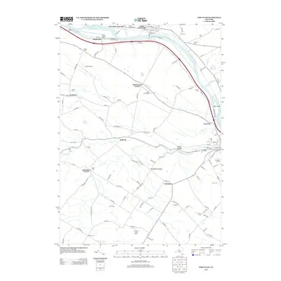
2013 Map of Fort Plain
USGS Topo · Published 2013About this map
The Mohawk River and the Erie Canal corridor define this region of Montgomery County, where transportation history and rural settlement patterns are deeply intertwined. Smaller hamlets like Mindenville, Hallsville, and Freysbush are connected by a network of local roads that follow the drainage patterns of Otsquago Cr and Bowmans Cr. The map is particularly notable for genealogists, as it documents numerous family-named cemeteries such as Nellis Cem, Klock Cem, Wiles Cem, and Dunkel Cem scattered throughout the countryside. Aviation and modern infrastructure are represented by several small airstrips, including Nellis Field Airport and Hickory Acres Airport, which sit alongside established river-front settlements like Saint Johnsville and Sand Hill.
Find a feature on this map
109 named features on this map. Tap any name to fly to it.
Don’t see what you’re looking for? This feature index may not catch every label — zoom into the map to look around manually.
Map Details
Editions of this 2013 Fort Plain Map
This is the sole edition of this map. No revisions or reprints were ever made.
Other maps of this area

1898 · Canajoharie
USGS Topo · 1:62,500

1900 · Little Falls
USGS Topo · 1:62,500

1900 · Canajoharie
USGS Topo · 1:62,500

1901 · Lassellsville
USGS Topo · 1:62,500

1902 · Canajoharie
USGS Topo · 1:62,500

1903 · Richfield Springs
USGS Topo · 1:62,500

1903 · Lassellsville
USGS Topo · 1:62,500

1903 · Little Falls
USGS Topo · 1:62,500

1939 · Little Falls
USGS Topo · 1:62,500

1943 · Sharon Springs
USGS Topo · 1:24,000