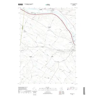
2019 Map of Fort Plain
USGS Topo · Published 2019About this map
Fort Plain and Nelliston anchor the eastern edge of this landscape where Otsquago Creek meets the Mohawk River. The corridor is defined by the historic water and rail routes of the Erie Canal and Mindenville, where the Barge Canal Bridge connects the local road network across the waterway. The map reveals a dense distribution of family and community burial grounds, such as Klock Cem, Edwards Cem, and Nellis Cem, reflecting generations of settlement in the valley. Moving south from the river, the terrain rises toward agricultural hamlets like Hallsville and Freysbush. The inclusion of Nellis Field and Hickory Acres Airport underscores the region's mid-century aviation infrastructure, while smaller crossings like Bowmans Cr and Caroga Creek continue to shape the rural topography between established corners such as Brookman Corners and Keesler Corners.
Find a feature on this map
102 named features on this map. Tap any name to fly to it.
Don’t see what you’re looking for? This feature index may not catch every label — zoom into the map to look around manually.
Map Details
Editions of this 2019 Fort Plain Map
This is the sole edition of this map. No revisions or reprints were ever made.
Other maps of this area

1898 · Canajoharie
USGS Topo · 1:62,500

1900 · Little Falls
USGS Topo · 1:62,500

1900 · Canajoharie
USGS Topo · 1:62,500

1901 · Lassellsville
USGS Topo · 1:62,500

1902 · Canajoharie
USGS Topo · 1:62,500

1903 · Richfield Springs
USGS Topo · 1:62,500

1903 · Lassellsville
USGS Topo · 1:62,500

1903 · Little Falls
USGS Topo · 1:62,500

1939 · Little Falls
USGS Topo · 1:62,500

1943 · Sharon Springs
USGS Topo · 1:24,000