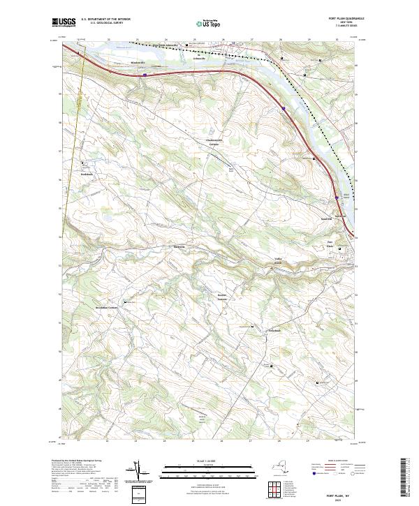
2023 Map of Fort Plain
USGS Topo · Published 2023About this map
The Mohawk River corridor serves as the primary artery for transport and industry in this region of Montgomery County. Running parallel to the river, the Erie Canal remains a defining landmark of New York’s heritage, situated near settlements like Mindenville and St. Johnsville. The terrain transitions from the valley floor into upland areas marked by small hamlets and historic intersections such as Charlesworth Corners, Hallsville, and Freysbush. Genealogists will find a high density of burial grounds including West Saint Johnsville Cem, Nellis Cem, and Wiles Cem. These sites, along with family-named roads like Klock Rd and Paris Rd, offer a detailed picture of the long-standing community ties in the valley. Aviation and recreation also leave their mark on the landscape through Nellis Field and the Hickory Acres Airport.
Find a feature on this map
99 named features on this map. Tap any name to fly to it.
Don’t see what you’re looking for? This feature index may not catch every label — zoom into the map to look around manually.
Map Details
Editions of this 2023 Fort Plain Map
This is the sole edition of this map. No revisions or reprints were ever made.
Other maps of this area

1898 · Canajoharie
USGS Topo · 1:62,500

1900 · Little Falls
USGS Topo · 1:62,500

1900 · Canajoharie
USGS Topo · 1:62,500

1901 · Lassellsville
USGS Topo · 1:62,500

1902 · Canajoharie
USGS Topo · 1:62,500

1903 · Richfield Springs
USGS Topo · 1:62,500

1903 · Lassellsville
USGS Topo · 1:62,500

1903 · Little Falls
USGS Topo · 1:62,500

1939 · Little Falls
USGS Topo · 1:62,500

1943 · Sharon Springs
USGS Topo · 1:24,000