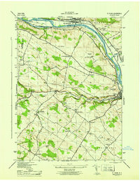
1946 Map of Fort Plain
USGS Topo · Published 1946About this map
The Mohawk River corridor serves as the primary artery for transportation and industry in this mid-century survey, flanked by the New York Central railroad and the Erie Barge Canal. The industrial and residential hubs of St Johnsville and Fort Plain anchor the riverbanks, while the surrounding uplands of Minden and Canajoharie are dotted with a dense network of district schools and family cemeteries.
Find a feature on this map
49 named features on this map. Tap any name to fly to it.
Don’t see what you’re looking for? This feature index may not catch every label — zoom into the map to look around manually.
Map Details
Editions of this 1946 Fort Plain Map
This is the sole edition of this map. No revisions or reprints were ever made.
Other maps of this area

1898 · Canajoharie
USGS Topo · 1:62,500

1900 · Little Falls
USGS Topo · 1:62,500

1900 · Canajoharie
USGS Topo · 1:62,500

1901 · Lassellsville
USGS Topo · 1:62,500

1902 · Canajoharie
USGS Topo · 1:62,500

1903 · Richfield Springs
USGS Topo · 1:62,500

1903 · Lassellsville
USGS Topo · 1:62,500

1903 · Little Falls
USGS Topo · 1:62,500

1939 · Little Falls
USGS Topo · 1:62,500

1943 · Sharon Springs
USGS Topo · 1:24,000