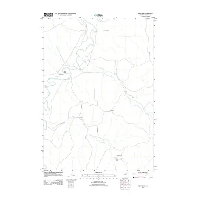
2012 Map of Fort Reno
USGS Topo · Published 2012About this map
Fort Reno and the winding course of the Powder River anchor this topographic view of Johnson County, Wyoming. The landscape is defined by the legacy of Western expansion, notably marked by the route of the Bozeman Trl as it cuts across the southern terrain. This modern survey illustrates the contemporary ranching economy through a network of named holdings including Reculusa Ranch, Robinson Ranch, and Urruty Ranch. Significant drainage patterns are visible along Reno Draw and Fort Reno Draw, while Streeter Rd provides access to the interior. The presence of Garrett Cow Camp near the Dry Fork Powder River reflects the continued agricultural use of these high plains. Water resources are localized, centering on small features like Streeter Reservoir and the seasonal flows of Little Willow Cr.
Find a feature on this map
19 named features on this map. Tap any name to fly to it.
Don’t see what you’re looking for? This feature index may not catch every label — zoom into the map to look around manually.
Map Details
Editions of this 2012 Fort Reno Map
This is the sole edition of this map. No revisions or reprints were ever made.
Other maps of this area

1953 · Hoe Ranch
USGS Topo · 1:24,000

1953 · Dry Fork Ranch
USGS Topo · 1:24,000

1953 · Fort Reno
USGS Topo · 1:24,000

1953 · Fort Reno SE
USGS Topo · 1:24,000

1953 · The Nipple
USGS Topo · 1:24,000

1954 · House Creek
USGS Topo · 1:24,000

1955 · Arminto
USGS Topo · 1:250,000

1958 · Arminto
USGS Topo · 1:250,000

1961 · Soldier Creek
USGS Topo · 1:24,000

1961 · Provence Ranch
USGS Topo · 1:24,000