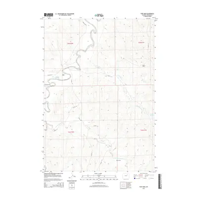
2015 Map of Fort Reno
USGS Topo · Published 2015About this map
The historic Fort Reno site overlooks the meandering path of the Powder River in this high-plains landscape of Johnson County. This survey highlights the enduring path of the Bozeman Trl, a legendary 19th-century overland route that remains visible across the terrain. The hydrology is dominated by the river and its tributaries, including the Dry Fork Powder River and Little Willow Cr, which carve a series of distinct drainage patterns such as Reno Draw and Holler Draw. Modern access to this storied frontier location is provided by Lower Sussex Rd and Streeter Rd. The map also captures local agricultural landmarks like the Streeter Reservoir and the Irigaray Rd corridor, illustrating how contemporary ranching infrastructure aligns with the area's deep history as a military and transit outpost.
Find a feature on this map
18 named features on this map. Tap any name to fly to it.
Don’t see what you’re looking for? This feature index may not catch every label — zoom into the map to look around manually.
Map Details
Editions of this 2015 Fort Reno Map
This is the sole edition of this map. No revisions or reprints were ever made.
Other maps of this area

1953 · Hoe Ranch
USGS Topo · 1:24,000

1953 · Dry Fork Ranch
USGS Topo · 1:24,000

1953 · Fort Reno
USGS Topo · 1:24,000

1953 · Fort Reno SE
USGS Topo · 1:24,000

1953 · The Nipple
USGS Topo · 1:24,000

1954 · House Creek
USGS Topo · 1:24,000

1955 · Arminto
USGS Topo · 1:250,000

1958 · Arminto
USGS Topo · 1:250,000

1961 · Soldier Creek
USGS Topo · 1:24,000

1961 · Provence Ranch
USGS Topo · 1:24,000