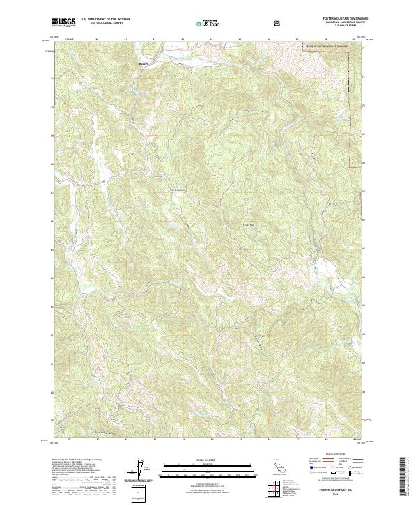
2021 Map of Foster Mountain
USGS Topo · Published 2021About this map
The settlement of Hearst serves as a focal point in this portion of the Mendocino National Forest, where the headwaters of the Russian River and the winding course of the Eel Wild and Scenic River define the local geography. The landscape is characterized by prominent peaks like Foster Mountain and deep drainages such as Bearskin Canyon and Dead-Horse Canyon. Historic access is documented through named routes like Hearst Post Office Rd and the descriptive Old Wagon Rd. Water sources are abundant throughout these ridges, including Soda Spring, Lake Lee, and numerous creeks such as Tomki Creek and Garcia Creek. This survey captures a remote section of Mendocino County where timber and water management intersect with protected wilderness areas, preserving the network of fire roads and trails that have long connected these isolated canyons.
Find a feature on this map
44 named features on this map. Tap any name to fly to it.
Don’t see what you’re looking for? This feature index may not catch every label — zoom into the map to look around manually.
Map Details
Editions of this 2021 Foster Mountain Map
This is the sole edition of this map. No revisions or reprints were ever made.
Other maps of this area

1922 · Willits
USGS Topo · 1:62,500

1929 · Eden Valley
USGS Topo · 1:62,500

1942 · Willits
USGS Topo · 1:62,500

1943 · Pomo
USGS Topo · 1:62,500

1944 · Willits
USGS Topo · 1:62,500

1951 · Laytonville
USGS Topo · 1:62,500

1952 · Eden Valley
USGS Topo · 1:62,500

1957 · Ukiah
USGS Topo · 1:250,000

1960 · Ukiah
USGS Topo · 1:250,000
1960 · Potter Valley
USGS Topo · 1:24,000