Loading...
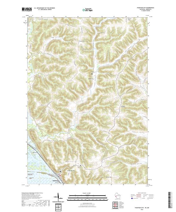
Loading map...2022 Map of Fountain City
USGS Topo · Published 2022About this map
Fountain City serves as the focal point of this river-valley landscape, situated where the bluffs meet the Mississippi River floodplain. The settlement's unique geography is defined by the steep transition from the riverbanks to the high plateau of Buffalo Ridge, a pattern typical of the Driftless Area. Numerous valleys, or coulees, cut through the terrain, including Schoepp Valley, Oak Valley, and Joos Valley, each providing natural corridors for local roads and farming.
Find a feature on this map
74 named features on this map. Tap any name to fly to it.
Don’t see what you’re looking for? This feature index may not catch every label — zoom into the map to look around manually.
Map Details
Date Portrayed2022
Date Published2022
PublisherU.S. Geological Survey
Map TypeTopographic
Scale1:24000
Physical Dimensions24 x 29 inches
Editions of this 2022 Fountain City Map
This is the sole edition of this map. No revisions or reprints were ever made.
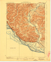
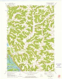
Historical Maps of Buffalo Through Time
3 maps found
Featured Locations
Source Details
SourceU.S. Geological Survey
CopyrightPublic Domain