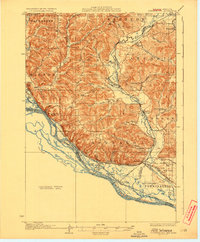
1929 Map of Fountain City
USGS Topo · Published 1929About this map
Fountain City serves as a primary hub on this 1920s riverfront survey, where the bluffs of Buffalo Ridge drop steeply toward the intricate network of the Mississippi River. The landscape is defined by a dense system of sloughs and chutes, including Crooked Slough and Homer Chute, which reflect the complex hydrology of the valley before modern channelization. The interior is a mosaic of narrow valleys and ridges, each settled with localized infrastructure such as Buffalo Ridge Sch and Doelle Sch.
Find a feature on this map
67 named features on this map. Tap any name to fly to it.
Don’t see what you’re looking for? This feature index may not catch every label — zoom into the map to look around manually.
Map Details
Editions of this 1929 Fountain City Map
2 editions found
Other maps of this area

1926 · Whitehall
USGS Topo · 1:62,500

1929 · Whitehall
USGS Topo · 1:62,500

1929 · Fountain City
USGS Topo · 1:62,500

1929 · Galesville
USGS Topo · 1:62,500

1930 · La Crescent
USGS Topo · 1:62,500

1932 · Cochrane
USGS Topo · 1:62,500

1932 · Gilmanton
USGS Topo · 1:62,500

1932 · Alma
USGS Topo · 1:62,500

1934 · Winona
USGS Topo · 1:62,500

1934 · Cochrane
USGS Topo · 1:62,500