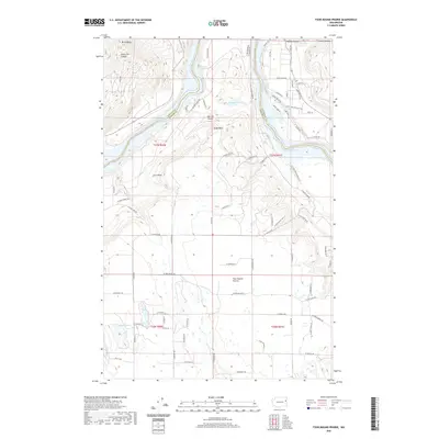
2020 Map of Four Mound Prairie
USGS Topo · Published 2020About this map
Four Mound Prairie anchors this portion of the Inland Northwest where the border between Stevens and Spokane counties follows the winding course of Long Lake. The landscape transition is marked by the sharp relief of Corkscrew Canyon and Holmes Canyon to the north, contrasted with the open plateau of the prairie to the south. Tightcliff Airport sits perched on a high bench near Eagle Rock, overlooking the Spokane River valley. The map reveals a dense network of local roads and residential clusters that have developed along the northern shores of Long Lake, particularly around Lakeview Dr and Myrtle Drive (Rd). Smaller water bodies like Knight Lake and Woods Lake dot the upland terrain, providing a look at the rural character and localized geography of the region as it appeared in the early 21st century.
Find a feature on this map
72 named features on this map. Tap any name to fly to it.
Don’t see what you’re looking for? This feature index may not catch every label — zoom into the map to look around manually.
Map Details
Editions of this 2020 Four Mound Prairie Map
This is the sole edition of this map. No revisions or reprints were ever made.
Other maps of this area

1943 · Medical Lake
USGS Topo · 1:62,500

1944 · Clayton
USGS Topo · 1:62,500

1944 · Wellpinit
USGS Topo · 1:62,500

1945 · Reardan
USGS Topo · 1:62,500

1950 · Clayton
USGS Topo · 1:62,500

1953 · Reardan
USGS Topo · 1:62,500

1953 · Wellpinit
USGS Topo · 1:62,500

1954 · Airway Heights
USGS Topo · 1:24,000

1954 · Medical Lake
USGS Topo · 1:62,500

1954 · Deep Creek
USGS Topo · 1:24,000