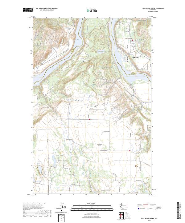
2023 Map of Four Mound Prairie
USGS Topo · Published 2023About this map
Suncrest sits on the high eastern banks of the Spokane River in this modern survey of the borderlands between Stevens and Spokane counties. The landscape is defined by the dramatic winding corridor of Long Lake, where the river broadens between steep canyon walls and points such as Eagle Rock and West Point. Away from the water, the terrain transitions into the namesake Four Mound Prairie, a distinct level plateau dotted with small water bodies like Knight Lake and Woods Lake. This area reflects a shift from the dense, residential development of the riverfront communities to the more open agricultural and aviation uses of the interior, exemplified by the private Tightcliff Airport. The intricate network of local roads, such as Corkscrew Dr and Lakeview Dr, illustrates the residential expansion along the ridge lines overlooking Holmes Canyon and the river valley below.
Find a feature on this map
76 named features on this map. Tap any name to fly to it.
Don’t see what you’re looking for? This feature index may not catch every label — zoom into the map to look around manually.
Map Details
Editions of this 2023 Four Mound Prairie Map
This is the sole edition of this map. No revisions or reprints were ever made.
Other maps of this area

1943 · Medical Lake
USGS Topo · 1:62,500

1944 · Clayton
USGS Topo · 1:62,500

1944 · Wellpinit
USGS Topo · 1:62,500

1945 · Reardan
USGS Topo · 1:62,500

1950 · Clayton
USGS Topo · 1:62,500

1953 · Reardan
USGS Topo · 1:62,500

1953 · Wellpinit
USGS Topo · 1:62,500

1954 · Airway Heights
USGS Topo · 1:24,000

1954 · Medical Lake
USGS Topo · 1:62,500

1954 · Deep Creek
USGS Topo · 1:24,000