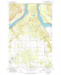
1973 Map of Four Mound Prairie
USGS Topo · Published 1977About this map
Four Mound Prairie occupies a wide bench above the Spokane River, where the river broadens into a reservoir controlled by Washington Water Power Co. The landscape is defined by the sharp transition from the flat agricultural plateau of the prairie to the steep, wooded coulees and basalt outcrops like Eagle Rock and Corkscrew that drop toward the water's edge. This 1973 survey shows a rural community structure centered around Central Sch and the Four Mound Fire Station, connected by a network of gravel roads such as Ritchey Road and Four Mound Road. Several small water bodies, including Knight Lake, Davis Lake, and Woods Lake, dot the southern and central terrain, illustrating the glacial and volcanic history that shaped the topography of the Stevens and Spokane County border.
Find a feature on this map
43 named features on this map. Tap any name to fly to it.
Don’t see what you’re looking for? This feature index may not catch every label — zoom into the map to look around manually.
Map Details
Editions of this 1973 Four Mound Prairie Map
This is the sole edition of this map. No revisions or reprints were ever made.
Other maps of this area

1943 · Medical Lake
USGS Topo · 1:62,500

1944 · Clayton
USGS Topo · 1:62,500

1944 · Wellpinit
USGS Topo · 1:62,500

1945 · Reardan
USGS Topo · 1:62,500

1950 · Clayton
USGS Topo · 1:62,500

1953 · Reardan
USGS Topo · 1:62,500

1953 · Wellpinit
USGS Topo · 1:62,500

1954 · Airway Heights
USGS Topo · 1:24,000

1954 · Medical Lake
USGS Topo · 1:62,500

1954 · Deep Creek
USGS Topo · 1:24,000