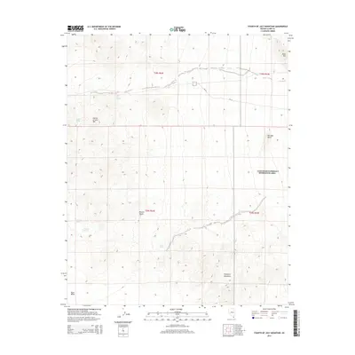
2014 Map of Fourth of July Mountain
USGS Topo · Published 2014About this map
Fourth of July Mtn dominates this arid landscape within the eastern reaches of the Mojave Desert. The terrain transitions from the high peaks of the Newberry Mountains down into the broad expanse of Piute Valley, characterized by a series of isolated water sources essential for desert survival. These include Indian Spring, Nicholson Spring, and Boat Tank Springs, which have long served as vital landmarks in this drainage-scored topography. A portion of the Lake Mead National Recreation Area is visible in the northeast, where landmarks like Bill Gays Butte and Black Mtn define the horizon. The presence of primitive routes like NPS 30 and NPS 31 suggests a landscape managed for limited access and conservation, preserving the character of these remote desert basins.
Find a feature on this map
18 named features on this map. Tap any name to fly to it.
Don’t see what you’re looking for? This feature index may not catch every label — zoom into the map to look around manually.
Map Details
Editions of this 2014 Fourth of July Mountain Map
This is the sole edition of this map. No revisions or reprints were ever made.
Other maps of this area

1886 · Camp Mohave
USGS Topo · 1:250,000

1892 · Camp Mohave
USGS Topo · 1:250,000

1926 · Nelson
USGS Topo · 1:96,000

1926 · Mohave City
USGS Topo · 1:96,000

1942 · Camp Mohave
USGS Topo · 1:250,000

1947 · Kingman
USGS Topo · 1:250,000

1948 · Kingman
USGS Topo · 1:250,000

1954 · Kingman
USGS Topo · 1:250,000

1955 · Kingman
USGS Topo · 1:250,000

1958 · Kingman
USGS Topo · 1:250,000