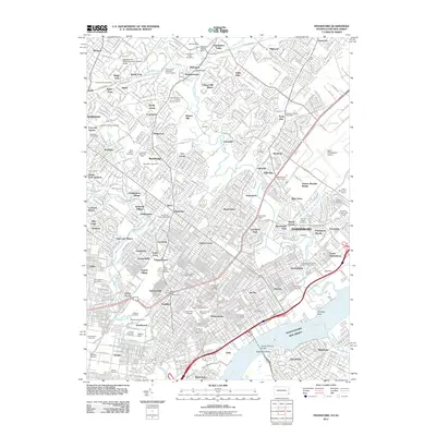
2011 Map of Frankford
USGS Topo · Published 2011About this map
The Delaware River waterfront and the dense urban grid of Northeast Philadelphia define this 2011 survey, showing a landscape deeply integrated with its industrial and commuter history. This area is notable for its concentration of historic burial grounds and memorial parks, ranging from the Abington Friends Cemetery in the north to the sprawling Greenwood Cemetery and Montefiore Cemetery. The map captures the transition from the consolidated neighborhoods of Frankford and Tacony to the more suburban reaches of Abington and Huntingdon Valley.
Find a feature on this map
129 named features on this map. Tap any name to fly to it.
Don’t see what you’re looking for? This feature index may not catch every label — zoom into the map to look around manually.
Map Details
Editions of this 2011 Frankford Map
This is the sole edition of this map. No revisions or reprints were ever made.
Other maps of this area

1888 · Mount Holly
USGS Topo · 1:62,500

1890 · Burlington
USGS Topo · 1:62,500

1891 · Philadelphia
USGS Topo · 1:62,500

1893 · Germantown
USGS Topo · 1:62,500

1893 · Burlington
USGS Topo · 1:62,500

1894 · Mount Holly
USGS Topo · 1:62,500

1894 · Philadelphia
USGS Topo · 1:62,500

1894 · Germantown
USGS Topo · 1:62,500

1896 · Germantown
USGS Topo · 1:62,500

1896 · Philadelphia
USGS Topo · 1:62,500
Featured Places
- Philadelphia, PA
- Abington Township, PA
- Cheltenham Township, PA
- Cinnaminson Township, NJ
- Lower Moreland Township, PA