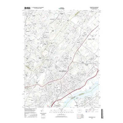
2016 Map of Frankford
USGS Topo · Published 2016About this map
Philadelphia and its surrounding communities are mapped here in the early 21st century, revealing a dense urban landscape defined by historical neighborhoods and numerous memorial grounds. The northeastern suburbs transition from established boroughs like Jenkintown and Abington into the industrial and residential corridors of Frankford, Tacony, and Wissinoming along the Delaware River. Large institutional footprints are prominent, including the Pennsylvania State University-Penn State Abington campus and the sprawling Northeast Philadelphia Airport. A significant concentration of burial sites, such as Montefiore Cem, Har Nebo Cem, and Abington Friends Cem, provides vital points of interest for genealogical research. The geography is further shaped by the winding courses of Pennypack Creek and Frankford Creek, while the Tacony-Palmyra Bridge serves as a critical connection over the Bridgesburg Channel to the New Jersey shoreline.
Find a feature on this map
84 named features on this map. Tap any name to fly to it.
Don’t see what you’re looking for? This feature index may not catch every label — zoom into the map to look around manually.
Map Details
Editions of this 2016 Frankford Map
This is the sole edition of this map. No revisions or reprints were ever made.
Other maps of this area

1888 · Mount Holly
USGS Topo · 1:62,500

1890 · Burlington
USGS Topo · 1:62,500

1891 · Philadelphia
USGS Topo · 1:62,500

1893 · Germantown
USGS Topo · 1:62,500

1893 · Burlington
USGS Topo · 1:62,500

1894 · Mount Holly
USGS Topo · 1:62,500

1894 · Philadelphia
USGS Topo · 1:62,500

1894 · Germantown
USGS Topo · 1:62,500

1896 · Germantown
USGS Topo · 1:62,500

1896 · Philadelphia
USGS Topo · 1:62,500
Featured Places
- Philadelphia, PA
- Abington Township, PA
- Cheltenham Township, PA
- Cinnaminson Township, NJ
- Lower Moreland Township, PA