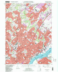
1997 Map of Frankford
USGS Topo · Published 1998About this map
The Delaware River forms the southeastern boundary of this densely developed corridor, where the urban grid of Northeast Philadelphia meets the suburban townships of Montgomery County. Residential and industrial growth is concentrated along the Conrail rail lines and major arteries like Roosevelt Boulevard. Extensive green space is preserved in the winding course of Pennypack Creek and Tacony Creek, which are flanked by parks and cemeteries such as Montefiore Cemetery and Lawnview Memorial Park. The map documents a mature landscape of institutions, featuring the Northeast Philadelphia Airport, the Aviation Supply Office, and numerous parochial schools like St Basil Academy. This late-twentieth-century survey illustrates the complete transition from earlier estates to a built-out environment of neighborhoods including Fox Chase, Rhawnhurst, and Wissinoming, while maintaining a strong institutional presence through hospitals and the House of Correction near the riverfront.
Find a feature on this map
144 named features on this map. Tap any name to fly to it.
Don’t see what you’re looking for? This feature index may not catch every label — zoom into the map to look around manually.
Map Details
Editions of this 1997 Frankford Map
This is the sole edition of this map. No revisions or reprints were ever made.
Other maps of this area

1888 · Mount Holly
USGS Topo · 1:62,500

1890 · Burlington
USGS Topo · 1:62,500

1891 · Philadelphia
USGS Topo · 1:62,500

1893 · Germantown
USGS Topo · 1:62,500

1893 · Burlington
USGS Topo · 1:62,500

1894 · Mount Holly
USGS Topo · 1:62,500

1894 · Philadelphia
USGS Topo · 1:62,500

1894 · Germantown
USGS Topo · 1:62,500

1896 · Germantown
USGS Topo · 1:62,500

1896 · Philadelphia
USGS Topo · 1:62,500
Featured Places
- Philadelphia, PA
- Abington Township, PA
- Cheltenham Township, PA
- Cinnaminson Township, NJ
- Lower Moreland Township, PA