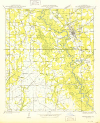
1950 Map of Franklinton
USGS Topo · Published 1950About this map
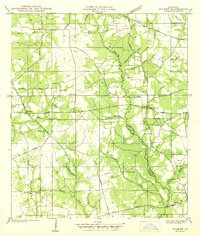
Franklinton sits as the focal point of this Washington Parish landscape, situated at the bend of the Bogue Chitto River. The map reveals a post-war rural infrastructure defined by an extensive network of state highways, such as State Highway No 34 and State Highway No 35, and the Gulf Mobile and Ohio railroad corridor. The area's social and community fabric is meticulously documented through numerous family-named burial grounds including Bickham Cem, Magee Cem, and Stafford Cem. Beyond the town, the economy appears tied to the land and river, indicated by Gravel Pt and various Old Gravel Pits along the riverbanks. Scattered educational and religious landmarks like Pine Ridge Sch and Bethel Ch provide essential touchpoints for genealogists tracing 1940s and 1950s settlement patterns near Richardson and Bickham.
Find a feature on this map
46 named features on this map. Tap any name to fly to it.
Don’t see what you’re looking for? This feature index may not catch every label — zoom into the map to look around manually.
Map Details
Editions of this 1950 Franklinton Map
This is the sole edition of this map. No revisions or reprints were ever made.
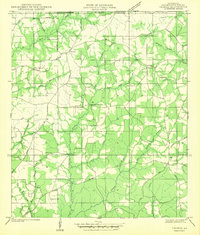
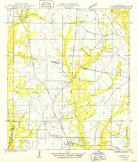
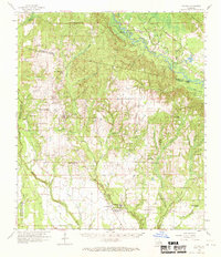
Other maps of this area

1939 · Zona
USGS Topo · 1:31,680
1939 · Sunny Hill
USGS Topo · 1:31,680
1939 · Clifton
USGS Topo · 1:31,680

1942 · Husser
USGS Topo · 1:31,680
1942 · Thigpen
USGS Topo · 1:31,680
1942 · Wilmer
USGS Topo · 1:31,680
1942 · Thomas
USGS Topo · 1:31,680
1950 · Folsom
USGS Topo · 1:31,680
1954 · Folsom
USGS Topo · 1:62,500

1954 · Baton Rouge
USGS Topo · 1:250,000