Loading...
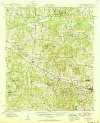
Loading map...1950 Map of Frankston
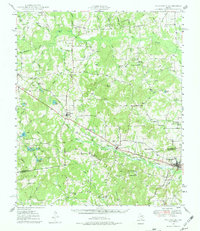
USGS Topo · Published 1950About this map
The Southern Pacific railroad corridor anchors the landscape of this 1950 survey, connecting the bustling center of Frankston with smaller settlements like Poynor and Larue. This region, split by the Henderson Co Anderson Co boundary, exhibits a complex network of rural infrastructure typical of the mid-century South. Education and community life are well-documented through landmarks like Central High Sch, Lapoynor Sch, and churches such as Mt Zion Ch and Bethel Ch.
Find a feature on this map
68 named features on this map. Tap any name to fly to it.
Don’t see what you’re looking for? This feature index may not catch every label — zoom into the map to look around manually.
Map Details
Date Portrayed1950
Date Published1950
PublisherU.S. Geological Survey
Map TypeTopographic
Scale1:62,500
Physical Dimensions17 x 20.9 inches
Editions of this 1950 Frankston Map
This is the sole edition of this map. No revisions or reprints were ever made.
Historical Maps of Athens Through Time
Featured Locations
Source Details
SourceU.S. Geological Survey
CopyrightPublic Domain