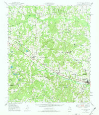
1949 Map of Frankston
USGS Topo · Published 1980About this map
Frankston serves as a primary hub for this portion of the East Texas landscape, where the Southern Pacific railroad cuts a diagonal path through the borderlands of Henderson Co and Anderson Co. The region's social geography is anchored by rural centers like Larue, Fincastle, and the curiously named New York, each surrounded by a dense network of country churches and family cemeteries. Educational life in the late 1940s is represented by Central High Sch and Lapoynor Sch, while the terrain is defined by low ridges like Tater Hill and the sprawling Anderson Marsh. The drainage patterns of Caddo Creek and Flat Creek dictate the placement of early settlements, revealing a community deeply tied to the land and the rail line before modern highway expansion altered the traditional movement between these small farm-to-market towns.
Find a feature on this map
79 named features on this map. Tap any name to fly to it.
Don’t see what you’re looking for? This feature index may not catch every label — zoom into the map to look around manually.
Map Details
Editions of this 1949 Frankston Map
3 editions found
Other maps of this area

1946 · Bullard
USGS Topo · 1:62,500

1948 · Bullard
USGS Topo · 1:62,500

1948 · Tyler
USGS Topo · 1:62,500

1948 · Brownsboro
USGS Topo · 1:62,500

1948 · Martins Mill
USGS Topo · 1:62,500

1949 · Tyler
USGS Topo · 1:62,500

1949 · Martins Mill
USGS Topo · 1:62,500

1949 · Brownsboro
USGS Topo · 1:62,500

1949 · Palestine
USGS Topo · 1:62,500

1949 · Frankston
USGS Topo · 1:62,500