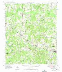
1949 Map of Frankston
USGS Topo · Published 1975About this map
The Southern Pacific railroad corridor serves as the primary artery for East Texas commerce in the late 1940s, connecting the bustling center of Frankston to the smaller settlements of Poynor and Larue. This landscape is defined by the transition between the rolling uplands of Cooper Mtn and the complex drainage systems of Caddo Creek and Catfish Creek. The map reveals a deeply rooted rural community, where social life is anchored by family-named landmarks and local institutions like Central High Sch and Lapoynor Sch.
Find a feature on this map
80 named features on this map. Tap any name to fly to it.
Don’t see what you’re looking for? This feature index may not catch every label — zoom into the map to look around manually.
Map Details
Editions of this 1949 Frankston Map
3 editions found
Other maps of this area

1946 · Bullard
USGS Topo · 1:62,500

1948 · Bullard
USGS Topo · 1:62,500

1948 · Tyler
USGS Topo · 1:62,500

1948 · Brownsboro
USGS Topo · 1:62,500

1948 · Martins Mill
USGS Topo · 1:62,500

1949 · Tyler
USGS Topo · 1:62,500

1949 · Martins Mill
USGS Topo · 1:62,500

1949 · Brownsboro
USGS Topo · 1:62,500

1949 · Palestine
USGS Topo · 1:62,500

1949 · Frankston
USGS Topo · 1:62,500