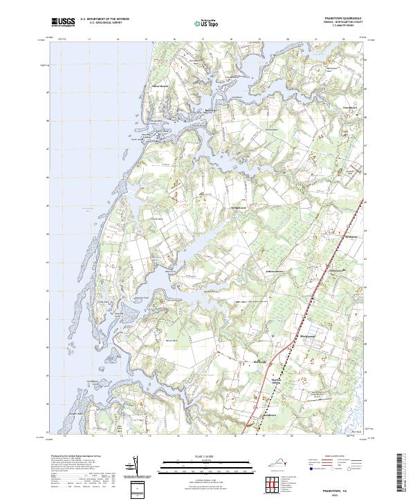
2022 Map of Franktown
USGS Topo · Published 2022About this map
Occohannock Neck and its series of finger-like landforms define this portion of Virginia's Eastern Shore, where the intricate tidal coastline meets the Chesapeake Bay. The map documents a landscape deeply tied to the water, featuring numerous necks such as Church Neck, Wilson Neck, and Old Town Neck that separate various creeks and coves. Small communities like Silver Beach, Bayford, and Bridgetown are scattered along the western waterfront, while the inland corridor is anchored by Machipongo and Franktown. The presence of Martins Siding and the Machipongo International Airport illustrates the modern transportation infrastructure that supports this rural coastal region. Significant maritime history is hinted at by features like The Saltworks near Gull Point, reflecting the long-standing importance of the area's aquatic resources and salt production.
Find a feature on this map
130 named features on this map. Tap any name to fly to it.
Don’t see what you’re looking for? This feature index may not catch every label — zoom into the map to look around manually.
Map Details
Editions of this 2022 Franktown Map
This is the sole edition of this map. No revisions or reprints were ever made.
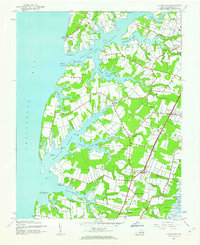
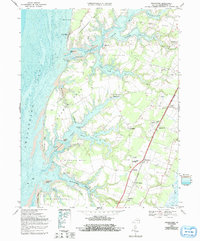
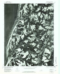
Historical Maps of Machipongo Through Time
4 maps found