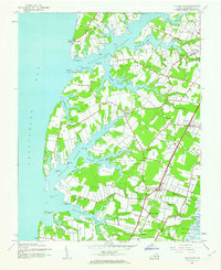
1943 Map of Franktown
USGS Topo · Published 1963About this map
The labyrinthine shoreline of Northampton County defines this landscape, where the Chesapeake Bay meets a series of deep tidal inlets. The Pennsylvania railroad line acts as a central spine for the region's inland settlements, connecting hubs like Birdsnest, Machipongo, and Shadyside with the industrial infrastructure at Martins Siding. Along the coastal necks, the map reveals a maritime economy transitioning between traditional wharf-side trade and emerging aviation, evidenced by Kellam Field and the historic Hungar Wharf and Taylor Whf.
Find a feature on this map
54 named features on this map. Tap any name to fly to it.
Don’t see what you’re looking for? This feature index may not catch every label — zoom into the map to look around manually.
Map Details
Editions of this 1943 Franktown Map
2 editions found
Other maps of this area

1942 · Cheriton
USGS Topo · 1:24,000

1942 · Cobb Island
USGS Topo · 1:24,000

1942 · Nassawadox
USGS Topo · 1:24,000

1943 · Nassawadox
USGS Topo · 1:31,680

1943 · Jamesville
USGS Topo · 1:31,680

1943 · Franktown
USGS Topo · 1:31,680

1943 · Exmore
USGS Topo · 1:24,000

1943 · Richmond
USGS Topo · 1:250,000

1944 · Exmore
USGS Topo · 1:31,680

1946 · Eastville
USGS Topo · 1:250,000