
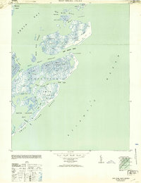
1942 Map of Cobb Island
USGS Topo · Published 1952About this map
The barrier islands and vast salt marshes of Virginia's Eastern Shore appear here just as the Army Map Service and Coast and Geodetic Survey documented them during the early 1940s. Centered on Cobb Island, the map reveals a fragile maritime landscape defined by shifting dunes and a complex network of tidal guts and bays. Navigational aids like The Spit Light and Mikes Sand Light indicate the vital importance of the Sand Shoal Channel to local mariners navigating the transition from the Atlantic Ocean into the protected waters of Cobb Bay.
Find a feature on this map
50 named features on this map. Tap any name to fly to it.
Don’t see what you’re looking for? This feature index may not catch every label — zoom into the map to look around manually.
Map Details
Editions of this 1942 Cobb Island Map
This is the sole edition of this map. No revisions or reprints were ever made.
Other maps of this area

1941 · Broadwater
USGS Topo · 1:62,500

1942 · Cheriton
USGS Topo · 1:24,000

1942 · Great Machipongo Inlet
USGS Topo · 1:24,000

1942 · Little Machipongo Inlet
USGS Topo · 1:24,000

1942 · Nassawadox
USGS Topo · 1:24,000

1943 · Nassawadox
USGS Topo · 1:31,680

1943 · Townsend
USGS Topo · 1:24,000

1943 · Franktown
USGS Topo · 1:31,680

1946 · Eastville
USGS Topo · 1:250,000
1953 · Ship Shoal Inlet
USGS Topo · 1:24,000