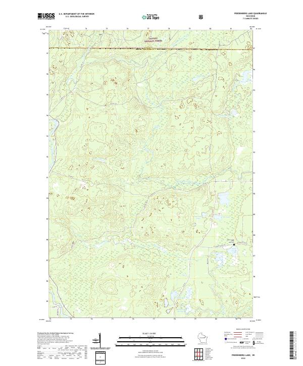
2022 Map of Fredenberg Lake
USGS Topo · Published 2022About this map
The S Br Oconto River and its various tributaries, including the First S Br Oconto River and South Branch Oconto River, define the water-rich landscape of this Menominee County interior. The map documents a territory dominated by the Nicolet National Forest and the protected corridor of the Wolf Wild and Scenic River. While the terrain is primarily forested wetlands and glacial lakes, human presence is centered around the Saint Joseph of the Lake Cem and the nearby Saint Joseph Lake. A network of Bureau of Indian Affairs routes, such as Bia Rte 104 and Bia Rte 151, provide access through the dense timberland. Notable landmarks include the Chipmunk Rapids and family-named water bodies like Vejo Lake and the cluster of La Belle Lake, Pine Lake, and Beauprey Springs to the south.
Find a feature on this map
37 named features on this map. Tap any name to fly to it.
Don’t see what you’re looking for? This feature index may not catch every label — zoom into the map to look around manually.
Map Details
Editions of this 2022 Fredenberg Lake Map
This is the sole edition of this map. No revisions or reprints were ever made.
Other maps of this area

1942 · Breed
USGS Topo · 1:48,000

1952 · Langlade
USGS Topo · 1:48,000

1952 · Mountain
USGS Topo · 1:48,000

1954 · Shawano
USGS Topo · 1:48,000

1954 · Iron Mountain
USGS Topo · 1:250,000

1955 · Green Bay
USGS Topo · 1:250,000

1956 · Gillett
USGS Topo · 1:62,500

1959 · Iron Mountain
USGS Topo · 1:250,000

1964 · Shawano
USGS Topo · 1:62,500
1973 · Mountain
USGS Topo · 1:24,000